
Civil engineering

From the trench to the interim payment application.

Pipeline construction and earthworks also need evidence: where work was done, when and how much. Plonda puts plans, captures and quantities on one map.

Coming · we are building this with pilot partners
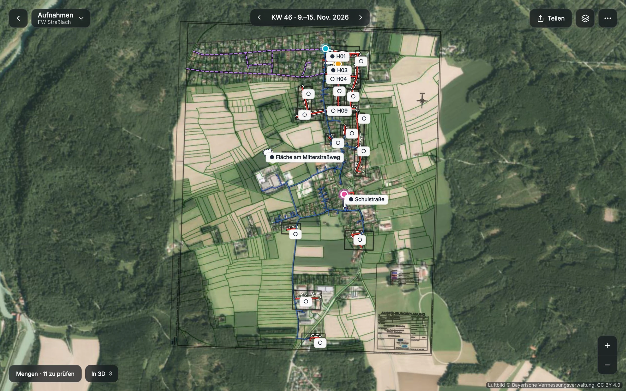
Map of a district heating build-out: execution plan on the aerial image, with the captures and stations of the weekA real pilot partner project

The key case

Where was work done, and when?.

Situation

The execution plan is available as a PDF, and the trenches are spread across several streets. The client asks where work was done this week.

Today

Photos in chat groups, plans in the office, location sketches by hand. The answer comes from the foreman's memory.

With Plonda

The plan sits on the aerial image. Every capture has its station and a date. The week bar shows what was captured in which week.

More cases

Quantities and pipelines.

How much was excavated?

Coming
Situation
For the interim payment application, the client wants excavation, shoring, pipe lengths and shut-off valves backed up.
Today
Measurement by hand, notes from the crew, second-hand figures.
With Plonda
The capture produces quantity rows with location and photo. You review every row, and only then does it go into the interim payment application.
Quantity list of a district heating build-out: excavation in cubic metres, each row with a review status

Where is the pipe?

Coming
Situation
In the plan, the pipes sit on named CAD layers, but nothing of that is visible on site.
Today
Anyone who wants to know where a pipe runs measures it from the plan or drives out to the site.
With Plonda
Plonda reads the pipes from the plan and places them on the map as a proposal, accurate to about one metre.
Map with pipelines from the plans and captured trenches in the street space

One project, both

You enable the map per project.

On for civil engineering, off for building construction. Walkthrough, site log, WhatsApp and reports work the same in both.

Building construction

Walkthrough per floor, plan comparison and interim payment application with evidence.

Civil engineering

Map with plan and aerial image, quantities with review status, pipelines from the plans.

In both

Site log, messages via WhatsApp and the weekly report.

Frequently asked questions

What site managers ask about civil engineering.

Does it exist yet?

We show the map and the quantity review on real pilot partner projects. We are developing the rest with them right now. If you work in civil engineering, talk to us.

Is this a survey?

No. Pipes from plans are accurate to about one metre. Quantities from the capture give a range, for example 16.5 to 17.5 metres. You review every row.

Do I need a BIM model?

No. Plonda works with your plans and the 360° capture.

See Plonda on your project.

Send us a walkthrough – we will show you the result on your own site.